Synopsis:
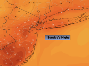
It’ll be a delightful Sunday as high pressure over the Southeast influences our region. Seasonal sunshine and breezy conditions can be expected.
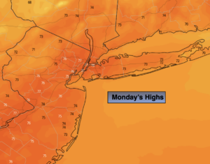
Monday will be a fall classic as it warms several degrees above the average high of the low 70s. A southwest flow around the high will be responsible for our mild readings.
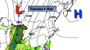
A cool front will move through the region Tuesday. A mix of sun and clouds is expected with spotty showers.
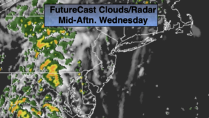
The coolest air of the young fall season so far will move in on Wednesday as Canadian airmass makes a visit. Readings will be several degrees below average through the end of the week.
Stay tuned.
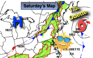
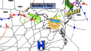
Sunday:
Sunny. Breezy. Highs in the lower 70s. Northwest winds at 10-20mph with gusts to near 30mph.
Tonight:
Clear and chilly. Lows in the upper 50s in the City, the 40s and 50s inland. West winds diminishing to 5mph.
Monday:
Mostly sunny. Warmer. Highs in the upper 70s.
Tuesday:
Sun and clouds. Spotty showers. Highs in the mid 70s.
Wednesday:
Partly sunny. Cooler. Highs in the upper 60s.
Thursday:
Mostly sunny. Cool. Highs in the mid to upper 60s.