Synopsis:
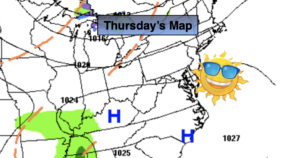
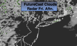
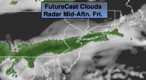
Today moisture will begin to build in from the South. This will increase our clouds. Spotty showers are possible this morning. A band of light rain will develop during the afternoon. Areas to the North may remain dry (1st map above).
Rain will develop tonight ahead of a developing low over the Southern Appalachians.
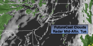
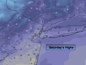
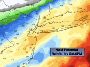
On Saturday the low will intensify as it moves up the Piedmont and off the Maryland coast during the afternoon. Rain is expected. The models have come into agreement that the storm will have a sharp cutoff from heavy rainfall totals to lighter amounts North and West (2nd map above). One to two inches of coastal rainfall is expected with much lighter amounts as you go North and West. Also, the low threat of any period of wet snow has diminished. That’s not to say the some wet snow may mix in especially to the North and East of the City during the afternoon. The rain will also taper off over Western sections during the day and around the NYC vicinity toward sunset. The day may end with an appearance from the sun, especially from the City and the the West.
Winds will be gusty. The strongest winds will be along the coast. Possible gusts over 40mph are possible, mainly to the East of the City.
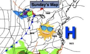
Sunday will be the better half of the weekend as the sun returns. Readings will be below average both days.
Tranquil but chilly conditions are expected early next week. Readings will be a few degrees below the average high of the upper 40s.
Stay Tuned.
Keep it here for a no nonsense, no hype forecast.
Today:
Mostly cloudy. Spotty morning showers. Afternoon light rain likely in most areas. Highs around 50º. Southwest winds at 5-10mph.
Tonight:
Rain developing. Lows around 40º in urban areas, the 30s inland. Southwest to North winds diminishing at 5-10mph.
Saturday:
Rain likely. Rain tapering off during the afternoon. Some afternoon sun especially West. Breezy. High in the 40s.
Sunday:
Partly sunny, breezy and chilly. High in the lower 40s.
Monday:
Partly sunny. High in the lower 40s.
Tuesday
Mostly sunny. High in the lower 40s.