Synopsis:
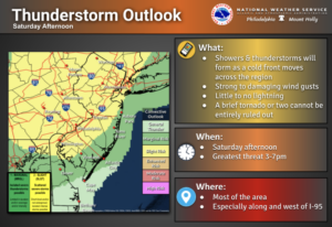
We’ll have more more warm day for Saturday. A mix of sun and clouds is expected. A cold front will be approaching during the afternoon with scattered showers and storms. Some of the storms may become severe. Keep an eye to the sky after 3pm.
A cool blast will arrive tonight with temperatures becoming quite chilly.
It’ll finally feel like Fall on Sunday with readings near the seasonal averages of the mid 60s with a gusty wind.
Fine Fall conditions will continue into the week as cool high pressure dominates. The breeze will continue.
Keep it here for a no hype-no nonsense forecast.
Stay tuned.
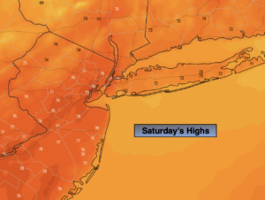
Saturday:
Clouds and sun. Afternoon showers. Isolated severe storms possible later in the afternoon and evening. Warm and breezy. Highs in the mid to upper 70s. South winds at 10-20mph with gusts to 30mph.
Tonight:
Becoming mostly clear and much cooler. Lows in the mid 50s in the City, the 40s inland. Northwest winds at 10-15mph.
Sunday:
Partly sunny, cooler and breezy (temperatures will actually be average for this time of the year). Highs in the mid 60s.
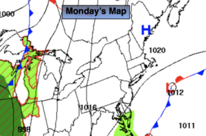
Monday:
Partly sunny. Highs around 60º.
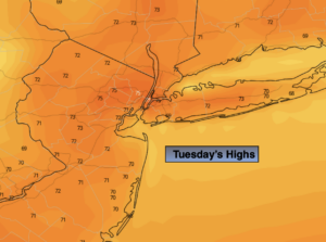
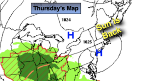
Tuesday:
Mostly sunny. Highs in the mid 60s.
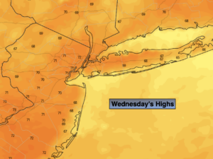
Wednesday:
Mostly sunny. Highs in the upper 60s.