Synopsis:
Today will be a gem. High pressure over the Northeast will supply the area with abundant sunshine, more comfortable readings and low humidity.
On Thursday, the high will move into the Atlantic. This will result in a flow off the ocean and mainly cloudy skies. Temperatures will be much cooler-remaining in the 70s. Upper level energy swinging through will spark scattered showers throughout the day. There will be dry times. By late Thursday afternoon and night a cool front will approach with scattered storms.
Friday will be a top ten day. High pressure over Southeastern Canada will provide the region with sunny skies and very low humidity.
A decent weekend is on the way with Saturday being the better of the two days. The high will move from the Eastern seaboard to off the coast by Sunday. Saturday will be spectacular. Sunny skies and low humidity is anticipated. Sunday will feature a mix of sun and clouds with the threat of scattered showers during the afternoon as a weak disturbance moves in from the West.
Keep it here for a no nonsense, no hype forecast.
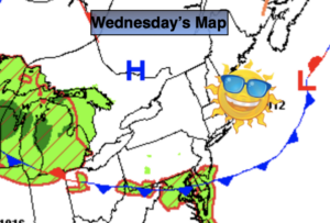
Wednesday:
Sunny. A top ten day. Highs in the lower to mid 80s. North to East winds at 5-10mph.
Tonight:
Becoming mostly cloudy. Lows in the 60s throughout. Southeast winds less than 5mph.
Thursday:
Mainly cloudy. Much cooler with scattered showers. Late day storms are possible. Highs in the mid 70s.
Friday:
Mostly sunny. Highs in the mid 80s.
Saturday:
Sunny. Highs in the lower 80s.
Sunday:
Sun and clouds. Scattered afternoon showers. Highs in the lower 80s.