Synopsis:
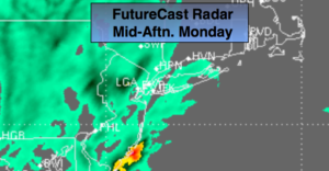
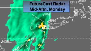
Low pressure just East of Delaware will move Northeast to South of Montauk Point by tonight. It looks like the last batch of steady and possibly heavy rain (on and off) will move through by mid-evening. Flooding is a concern where the rain amounts are the highest. The rain will taper off this evening and skies will remain cloudy.
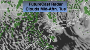
Spotty showers are expected Tuesday as the upper level low moves through, especially during the afternoon and evening. It will still be unseasonably cool.
We’ll finally dry out Wednesday as high pressure moves from the Southern Appalachians to Eastern North Carolina.
Morning showers are possible Thursday otherwise skies will become partly sunny. Friday is looking decent.
Temperatures remained in the ridiculously cold 40’s today. Readings will slowly climb to near seasonal averages by the end of the week. Crazy Spring weather!
Keep it here for a no nonsense, no hype forecast.
Stay tuned.
Rest of Today Into this Evening:
On and off rain. Some of the rain will be heavy. Chilly with readings in the 40s.
Tonight:
Mostly cloudy. Cold. Lows in the lower 40s. Northeast winds becoming North at 5-10mph.
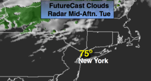
Tuesday:
Mostly cloudy with scattered showers. Highs in the mid 50s.
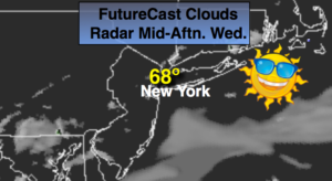
Wednesday:
Partly sunny. Highs in the mid 60s.
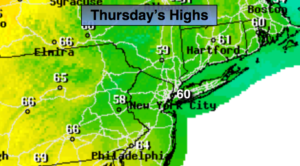
Thursday:
Scattered morning showers, otherwise becoming partly sunny. Highs in the upper 60s.
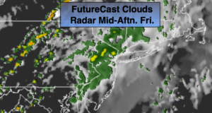
Friday:
Partly sunny. Highs in the upper 60s.
Saturday:
Partly sunny. Warmer. Highs in the mid 70s.