Synopsis:
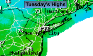
The rain and clouds will clear the coast during the early to mid morning hours and the sun will return as a cool front moves offshore. It will be delightful with readings near the seasonal average of 77º.
Tonight will be clear and cool with lows dropping into the upper 40s well inland!
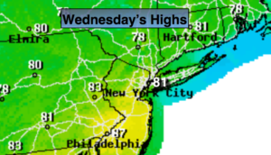
Wednesday will be a gem as high pressure moves in from the Ohio Valley.
On Thursday a low will ride up the coast. A period of rain is likely.
Friday will be mainly sunny as high pressure moves along the East coast. This high pressure will move off the coast for Saturday. The flow around the high will become Southwest. Readings will be above average.
The weather at this point for Father’s Day should cooperate.
Keep it here for a no nonsense, no hype forecast.
Today:
Early morning rain East, otherwise becoming mostly sunny. Highs in the mid to upper 70s. Northwest winds at 10-20mph with higher gusts.
Tonight:
Clear and cool. Lows near 60º in the City, the upper 40s well inland. Northwest winds diminishing to 5-10mph.
Wednesday:
Mostly sunny. Highs in the mid 70s.
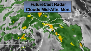
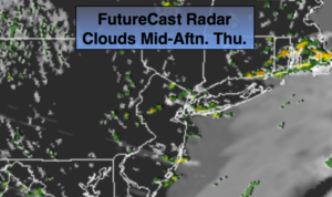
Thursday:
Mostly cloudy. A period of rain is likely. Highs in the lower 70s.
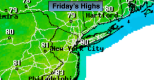
Friday:
Partly sunny. Highs in the mid 70s.
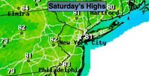
Saturday:
Partly sunny. Warm. Highs around 80º.