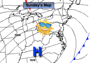
Synopsis:
Sunday will be the better half of the weekend with early clouds (and a morning shower in spots) giving way to mainly sunny skies. High pressure to our North and West will funnel in the drier, cooler airmass.
Tonight will be the coldest night of the season so far with all areas dipping well below freezing.
Monday will be bright and chilly as the high moves over the region.
Winter’s arrival on Tuesday will be a seasonal one. Abundant sunshine is expected as high pressure remains in control. Not much will change for Wednesday and Thursday. A storm will move up and well off the coast.
It looks like we’ll have to wait another year for the possibility of a white Christmas. I’m just the messenger!
Stay tuned..
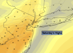
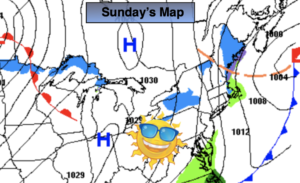
Sunday:
Morning clouds (a spot shower around sunrise) will give way to sunny skies. Cooler and breezy. Highs in the lower 40s. Northwest winds at 15-25mph.
Tonight:
Clear and cold. Lows in the upper 20s along the coast, the teens and 20s inland. Diminishing Northwest winds at 5mph.
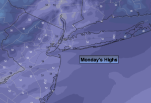
Monday:
Sunny. Chilly. Highs in the upper 30s.
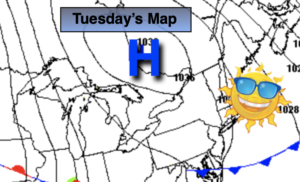
Tuesday:
Sunny. Seasonal. Highs in the mid 40s.
Wednesday:
Mostly sunny. Highs in the mid to upper 40s.
Thursday:
Sunny. Highs in the lower 40s.