Synopsis:
A cold front will move through early tonight with scattered showers and possibly a thunderstorm. A brief period of heavy rain and high winds is possible with the passage of the front. Skies will clear and winds will be gusty thereafter.
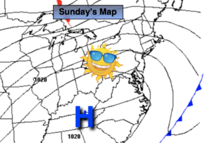
The sun will return for Sunday. We’ll come back down to reality. Temperatures will be tolerable for mid December.
Monday through Thursday will feature abundant sunshine and milder readings as high pressure settles along the East coast. Readings will be well above the average high of the mid 40s.
Our thoughts and prayers go out to those affected by the violent tornadoes the past 36 hours. It was an unprecedented event.
Stay tuned..
Tonight:
Scattered showers and possibly a thunderstorm is possible early tonight. A brief period of heavy rain and high winds is possible. Lows in the mid to upper 40s in the City, the upper 30s inland. Winds becoming Northwest at 15-30mph with gusts to 45mph.
Sunday:
Mostly sunny. Cooler. Highs in the upper 40s. West to Northwest winds at 10-15mph.
Monday:
Sunny. Mild. Highs in the lower 50s.
Tuesday:
Sunny. Mild. Highs in the lower to mid 50s.
Wednesday:
Sunny. Mild. Highs in the lower to mid 50s.
Thursday:
Mostly sunny. Warm. Highs near 60º.