Synopsis:
The first weekend of December will be a tranquil one. We all know it could much worse. High pressure will basically be in control. A mix of sun and clouds are expected with readings near seasonal averages. The average high is in the upper 40s.
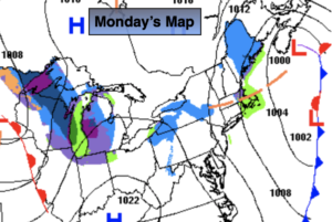
Ahead of a cold front on Monday it will be balmy. Readings will pop into the lower 60s. Showers are likely later in the day.
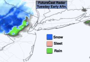
Much colder conditions are expected for Tuesday as high pressure moves in from the North.
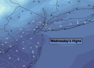
On Wednesday many of the models have an area of low pressure developing to our South. The exact track will determine how much precipitation, if any will fall. There will be cold high pressure to the North. At this time, the forecast is for the possibility of rain with the potential of some wet snow inland. Again, this is many days out and this forecast will change.
You know where to find a no hype, no nonsense forecast.
Stay tuned..
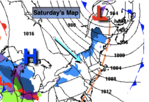
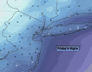
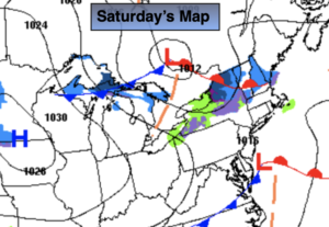
Saturday:
Sun and clouds. Highs in the mid to upper 40s. Northwest winds at 5mph.
Tonight:
Partly cloudy. Lows in the mid 30s in the City, the 20s elsewhere. Northwest winds 5-10mph.
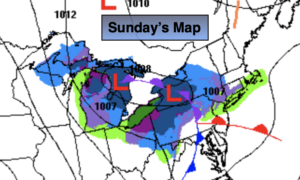
Sunday:
Mostly sunny. Highs in the mid to upper 40s.
Monday:
Mostly cloudy. Balmy. Afternoon showers. Highs in the lower 60s.
Tuesday:
Mostly sunny. Much colder. Highs in the lower 40s.
Wednesday:
Potential for rain mixed with wet snow inland. Highs around 40º.