Synopsis:.
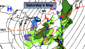
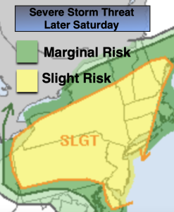
*** Tornado and Severe Thunderstorm Watch until 10pm***A strong cold front will approach this evening with showers and scattered thunderstorms. Some of the storms maybe severe with winds in excess of 58mph. An isolated tornado is possible in any severe storm. Please keep an eye to the sky for threatening weather this evening.
Any showers and storms will taper off around midnight. All areas will remain above freezing.
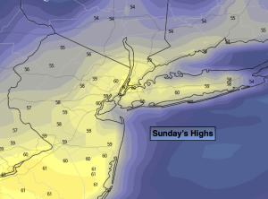
Sunday will be the cooler half of the weekend with a Canadian airmass moving in, at least it’ll be sunny.
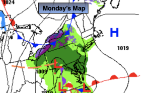
Temperatures will rebound nicely on Monday and Tuesday as high pressure moderates and the sun dominates.
Readings will warm even further midweek as high pressures moves off the coast and a Southwest flow dominates. A mix of sun and clouds is expected with a chance of afternoon showers later Thursday.
Stay tuned.
Keep it here for a no nonsense, no hype forecast.
Tonight:
Spotty showers and isolated severer storms early. Lows around 40º in the City, the 30s inland. West to Northwest 15-30mph with gusts to 45mph.
Sunday:
Sunny, windy early. Much cooler. Highs in the lower 50s. Northwest winds at 15-30mph with gusts to 35mph in the morning. Winds diminishing to 8-15mph later in the day.
Monday:
Sunny. Milder. Highs in the lower 60s.
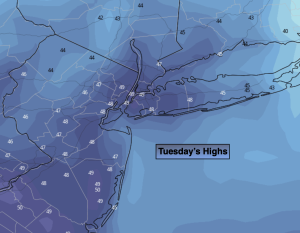
Tuesday:
Partly sunny. Mild. Highs in the mid 60s.
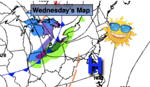
Wednesday:
Partly sunny. Warm. Highs in the upper 60s.
Thursday:
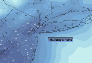
Sun to clouds. Warm. Chance of afternoon showers. Highs around 70º.