Synopsis:.
Basically what you see is what you get this week. The jet stream will be swinging out of Canada and high pressure at the surface won’t budge much. Temperatures will be below the average high of 65º by about five degrees the entire week. A mix of sun and clouds is expected each day. A brief shower is possible later Wednesday afternoon with upper level energy working through.
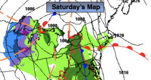
By Saturday the atmosphere will begin to wake up. A few storms will be on the map. One to our South the other to our West. The latest computer guidance suggests the Southern low will make a run for our area. The chance of rain now has been included in the forecast for Saturday.
Stay tuned.
Keep it here for a no nonsense, no hype forecast.
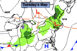
Tuesday:
Mostly sunny. Cool. Highs around 60º. Northwest winds at 5-10mph.
Tonight:
Partly cloudy. Lows in the mid 40s in the City, the 30s inland. Scattered frost North and West. Light North winds.
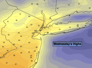
Wednesday:
Becoming mostly cloudy. Scattered afternoon showers. Cool. Highs in the upper 50s.
Thursday:
Mostly sunny. Cool. Highs in the lower 60s.
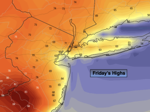
Friday:
Partly sunny. Highs in the lower 60s.
Saturday:
Chance of rain. Highs in the upper 50s.