Synopsis:
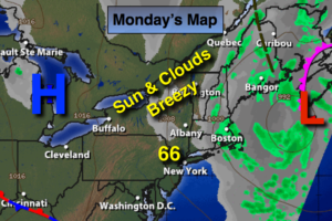
The slow moving storm that affect our weather this past weekend will continue to move East of Maine today. The difference in pressure between the low of the coast and high pressure over the Great Lakes will cause gusty wind. The winds will gust up to 35mph at times. A mix of sun and clouds is expected. A few spotty showers may occur North and East of the City.
Much warmer times are in our future as we head through the week. A Bermuda high will result in Summer-like temperatures with readings possibly reaching record highs on Thursday.
Stay tuned.
Today:
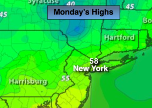
Partly sunny and breezy. Northwest wind at 15-25mph with gusts to 35mph.
Tonight:
Mostly clear with diminishing winds. Lows in the in the mid 50s in the City, the 40s inland. Northwest winds diminishing to 8-12mph late.
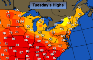
Tuesday:
Mostly sunny, milder. Highs in the mid 70s.
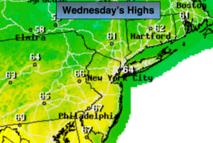
Wednesday:
Mostly sunny, warm. Highs in the mid to upper 80s.
Thursday:
Hazy, hot and humid. Highs around 90º.
Friday:
Mostly sunny, warm and less humid. Highs in the lower 80s.
Keep it here for a no nonsense, no hype forecast.