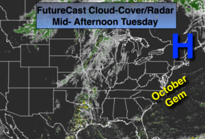
Synopsis:
A string of beautiful October days will be with us through the week. An extensive area of high pressure will dominate the East coast with plenty of sunshine. Temperatures will warm as the wind turns Southwest. Readings will be well above average through the end of the week into the weekend. The average high is 69º.
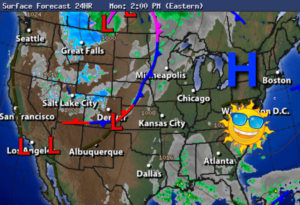
A weak cool front will move through Friday basically uneventful. A spot shower is possible but most areas should be rain free. Speaking of rain, much of the tri-state area is in a dry spell. Widespread significant rain hasn’t fallen in several weeks and a steady rain is not in our near future.
High pressure will once again move in for the weekend resulting in sunny, warm conditions.
Today:
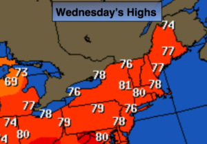
Sunny and warmer. Highs in the mid to upper 70s. Southwest wind at 8-12mph.
Tonight:
Mostly clear, not as cool as recent nights. Lows in the lower 60s in the City, the mid to upper 50s inland. Southwest wind 5-10mph.
Thursday:
Partly sunny and warm. Highs around 80º.
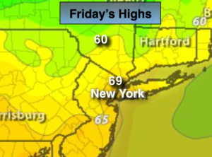
Friday:
Sun and clouds. A spotty shower is possible Highs in the mid 70s.
Saturday:
Mostly sunny. Highs in the mid 70s.
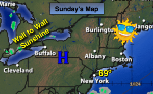
Sunday:
Partly sunny and warm. Highs in the upper 70s.
Keep it here for a no nonsense, no hype forecast.