Synopsis:
High impact storm will affect the region from mid-afternoon through late tonight.
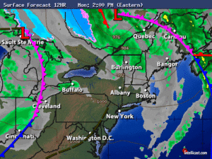
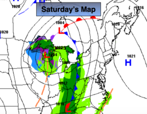
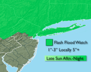
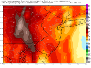
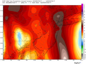
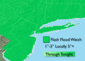
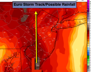
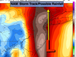
A potent cold front and developing storm along the coast will result in rain developing today. The rain will be heavy at times during the afternoon and evening. 1″-3″ of rain is possible with locally up to 5″+ by late tonight. At this time, the thinking is the heaviest rainfall may occur along the storm track. The exact track of the storm is in disagreement between the Euro and the NAM model (by only 50 miles or so). The top rainfall map is the European model. The Euro tracks the storm from the Delaware coast to the Eastern Poconos, hence the heaviest rain falls over Western areas. The bottom map is the NAM model. This model depicts the storm tracking along the immediate NJ coast into NYC. High rainfall totals occur along this corridor. Whatever the exact track significant rainfall is likely and a Flash Flood Watch has been posted for the entire tri-state area. Don’t drive through a flooded roadway. You don’t know how deep the water is. Turn around-don’t drown.
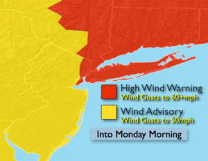
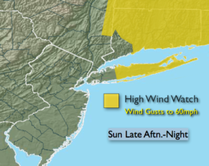
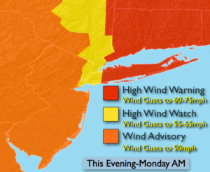
With the storm intensifying so rapidly strong Southeast to South winds will occur along the coast and especially over Long Island and coastal Connecticut this evening into tonight. Gusts could reach 60mph in the City. Possible gusts to hurricane force over Long Island. High Wind Warning, Watches and advisories have been posted. Secure any loose objects outdoors. Scattered power outages are possible.
Behind the storm strong Northwest winds are likely Monday. Scattered showers are possible Monday morning. Skies will become partly sunny with strong winds continuing during the day. Gusts to 50mph are likely.
More tranquil conditions are expected for Halloween.
Stay tuned.
Today:
Cloudy with rain developing. The rain will become heavy at times during the afternoon and evening. Southeast winds increasing to 15-25mph with gusts to 50mph by evening at the coast.
Tonight:
Rain, heavy at times through midnight, then scattered showers. Windy. Southeast winds at 15-30mph with gusts to 40-50mph inland until midnight. Winds will gust to 60-75mph until midnight from the City North and East. Winds will then switch to the West and gusts to 50mph at times throughout overnight.
Monday:
Morning showers otherwise becoming partly sunny, windy and cooler. Highs in the mid to upper 50s. West winds at 15-30mph with gusts to 50mph.
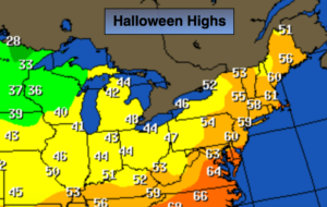
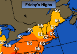
Halloween:
Partly sunny, breezy and cool. Highs in the upper 50s.
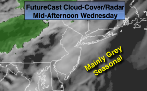
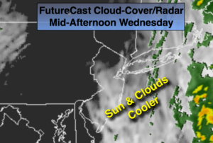
Wednesday:
Morning sun, afternoon clouds. Highs in the upper 50s.
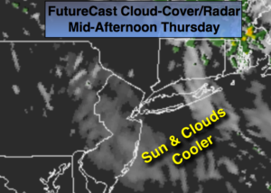
Thursday:
Clouds and sun. Mild. Highs in the mid 60s.
Keep it here for a no nonsense, no hype forecast.