Synopsis:
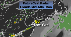
Spotty showers and storms will continue into this evening. Not all areas will get wet. A cool front will pass through tonight. This will usher in a refreshing airmass from Canada as high pressure moves in. Temperatures will come down to seasonal levels (lower 70s) Tuesday and Wednesday under mainly sunny skies. A couple of gems are on the way.
The weather looks to cooperate for the end of the week and into the Memorial Day Holiday Weekend. No major systems look to affect the region. High pressure will be nearby. Temperatures will be comfortable in the 70s. Keeping our fingers crossed!
Keep it here for a no nonsense, no hype forecast.
Stay tuned.
Tonight:
Scattered evening storms, otherwise, becoming partly cloudy and cooler. Lows in the 50s throughout. Northwest winds at 10-15mph.
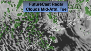
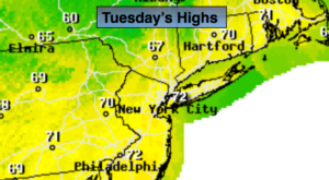
Tuesday:
Mostly sunny, breezy and more seasonal. Highs in the lower 70s. Northwest winds at 10-20mph.
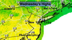
Wednesday:
Sunny. Highs in the lower 70s.
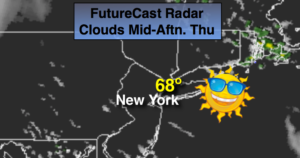
Thursday:
Partly sunny. A spot shower is possible. Highs in the mid 70s.
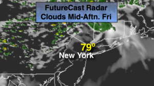
Friday:
Partly sunny. Highs in the mid 70s.
Saturday:
Partly sunny. Highs in the mid 70s.