Synopsis:
An upper level disturbance will move through the region this morning with scattered showers and isolated storms. It’ll be much cooler due to the rain-cooled air and clouds. The sun may make a return at times especially North of the City.
As we turn the page to August this weekend the humidity will return. Hazy skies are expected both days. It will warm and mainly dry. Spotty storms are possible on Sunday it will be steamy.
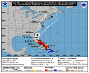
All eyes then turn to Hurricane Isaias. The storm will head through the Bahamas today and Saturday. Where it goes from there is still uncertain. The storm will head North. Will it be into Florida or stay offshore? From there the track will be up the coast-inland, along the coast or offshore? The track will determine what conditions will occur in the tri-state area. The track map is above. As you can see the cone of uncertainly expands through time. This will be fine-tuned over the weekend.
Stay Tuned.
Keep it here for a no nonsense, no hype forecast.
Today:
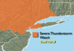
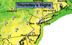
Scattered showers mainly during morning. A spot storm is possible South this afternoon. The sun may make an appearance as well, especially North of the City. Cooler. Highs around 80º. Northeast winds at 5-10mph.
Tonight:
Partly cloudy. Lows in the lower 70s in urban areas, the 60s inland. North wind less than 5mph.
Saturday:
Partly sunny. Highs in the mid to upper 80s.
Sunday:
Hazy, warm and humid. Chance of a spotty storm. Highs in the mid to upper 80s.
Monday:
Hazy, warm and humid. Chance of scattered showers and storms. Highs in the mid 80s.
Tuesday:
Scattered showers and storms. Humid. Highs in the lower 80s.