Synopsis:
Tropical Storm Isaias which battered the area continues to move into New England. The storm was responsible for flooding rains, damaging winds, isolated tornadoes and power outages. In it’s wake it will become more tranquil later today and into tonight. Winds will diminish and skies will become mostly clear.
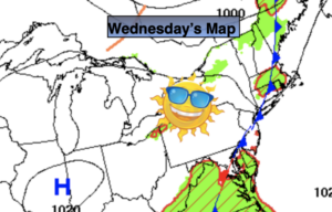
A much needed calm day is on the way for Wednesday. High pressure will dominate and so will the sun. It’ll be warm and the humidity will be tolerable.
Thursday and Friday a weak system from the South will try to nudge a bit to the North. A mix of sun and clouds is expected with the possibility of spotty afternoon storms.
The weekend looks spectacular with plenty of sun and warm temperatures with high pressure in control.
Stay Tuned.
Keep it here for a no nonsense, no hype forecast.
Tonight:
Becoming mostly clear. Less humid. Lows in the lower 70s in urban areas, the 60s inland. Southwest to West winds diminishing to 5-10mph.
Wednesday:
Mostly sunny. Highs in the mid 80s. West to Southwest winds at 5-10mph.
Thursday:
Partly sunny. Spotty PM storm. Highs in the lower to mid 80s.
Friday:
Partly sunny. Spotty PM storm. Highs in the mid 80s.
Saturday:
Mostly sunny. Highs in the mid 80s.
Sunday:
Mostly sunny. Highs in the mid to upper 80s.