Synopsis:
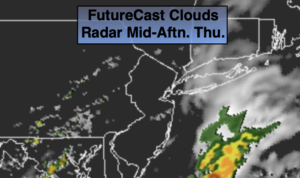
Today and Friday a weak system from the South will nudge to the North. This will result in unsettled weather for parts of the region. An area of rain will work through Central and Southern areas this morning. North of the City it will be mainly dry. Skies will be mostly cloudy this morning but the sun should make an appearance from time to time later today. It will be much cooler with the clouds and push of cooler air from the North.
A few showers will dot the region tonight under mainly cloudy skies. Readings will be comfortable for sleeping.
Friday, once again, will be mainly cloudy and co0l with scattered showers and an isolated storm. Temperatures will not be feeling like August.
The pesky disturbance will move off the coast Saturday morning. Clouds and any spotty showers will give way to sunshine. Readings will be several degrees below the average high of the mid 80s. Sunday will be the better half of the weekend. High pressure will move in. Abundant sunshine and warm readings is expected.
Stay Tuned.
Keep it here for a no nonsense, no hype forecast.
Today:
Areas of rain and scattered showers this morning mainly over Central and Southern areas. Otherwise peeks of sun later today, with a spot shower. Much cooler. Highs in the upper 70s. Northeast to Southeast winds at 5-10mph.
Tonight:
Mostly cloudy. Spotty showers are possible. Lows in the 60s throughout. South to Northeast winds at 5mph.
Friday:
Mainly cloudy. Scattered showers and storms. Unseasonably cool. Highs in the mid 70s.
Saturday:
Early clouds and spotty showers, otherwise becoming partly sunny. Highs around 80º.
Sunday:
Sunny and warm. Highs in the upper 80s.
Monday:
Mostly sunny, hot and humid. Highs around 90º.