Synopsis:
Merry Christmas!
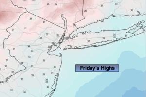
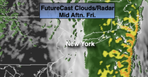
The rain will end from West to East during the from late morning through early afternoon. Clouds should break for some sun during the afternoon, especially from the City and to the West. Morning highs occurred after midnight (most regions were at or above 60º!). Once the powerful cold front swings offshore readings will plummet through the the 40s and end up in the upper 30s by sunset.
A freeze is expected tonight. Any standing water will become ice.
Saturday will be sunny but cold readings will flirt with freezing as high pressure works in from the Northwest.
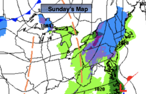
Seasonal sun is expected on Sunday.
A mix of sun and clouds are expected for Monday as a weak low moves well to our North and West.
Tuesday will be bright but colder as high pressure moves in from the West.
Wishing you a Merry Christmas. May we relax and enjoy loved ones safely!
Stay Tuned.
Keep it here for a no nonsense, no hype forecast.
Christmas Day:
Morning rain will taper off from West to East. Clouds will give way to some afternoon sun, especially West. Temperatures will fall during the day. Highs will be near 60º early in the morning. Readings will fall into the upper 30s by late day. South to West winds at 15-30mph.
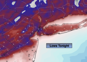
Tonight:
Mostly clear and much colder. Lows in the 20s throughout. West winds at 15-25mph.
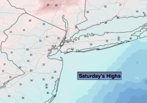
Saturday:
Mostly sunny and cold. Highs around freezing.
Sunday:
Sunny and seasonal. Highs near 40º.
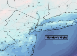
Monday:
Partly sunny. Milder. Highs in the mid to upper 40s.
Tuesday:
Sunny. Colder. Highs in the mid 30s.