Synopsis:
A weak system will pass well South of the area today. Clouds will dominate with peeks of sun. Readings will remain below freezing.
Tonight will be partly cloudy and frigid once again with lows dipping into the single digits in spots outside the urban corridor.
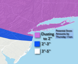
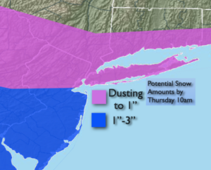
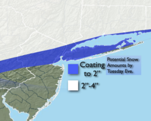
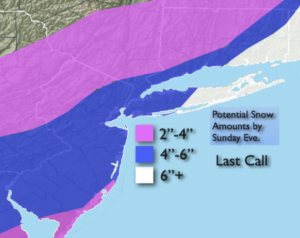
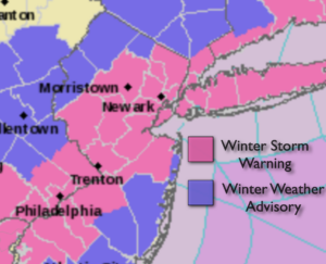
The weekend will start with a bit of sun Saturday morning but clouds will lower and thicken. A developing coastal low over the Carolinas will move Northeast and throw some light snow or a mix our way Saturday evening and night. The storm will move up and off the NJ coast by Sunday morning. Light snow, mix and rain along the Southern coastal areas will wind down on Sunday. This low will not be a big precipitation producer. A light accumulation of snow and ice is possible, especially inland (think a coating). Skies should remain mostly cloudy for Valentine’s Day afternoon.
Presidents’ Day now looks more grey. The latest computer guidance keeps enough moisture with an active jet stream moving up the Piedmont to produce an on and off light mix. This will not be a big deal, but we’d like some sun already! The cold will remain with highs only around 30º.
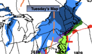
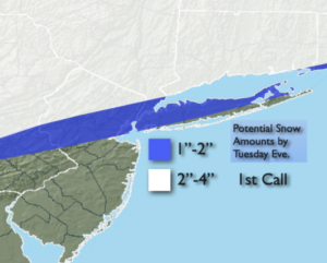
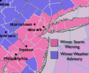
The next storm will affect our weather Monday night into Tuesday with the potential of snow or a mix. This storm will should be a significant precipitation producer. The track here is key. Arctic high pressure will be to our North. How much warm air works in is yet to be determined. The threat is there for significant snow, freezing rain and or sleet for much of the area. Rain may fall for a time over Southern sections as well.
Needless to say, we are in a very active pattern.
Stay Tuned.
Keep it here for a no nonsense, no hype forecast.
Today:
Clouds, some sun. Very cold. Highs in the upper 20s. North wind at 5mph.
Tonight:
Mostly cloudy. Frigid. Lows around 20º in the City, the single digits and teens inland. North winds at 5mph.
Saturday:
Mostly cloudy. Cold. Chance of a bit of light snow or a mix toward evening. Highs around 30º.
Sunday (Valentine’s Day):
Morning light snow/mix/rain depending on location. The precipitation will taper off and skies will remain mostly cloudy during the afternoon. Highs in the lower to mid 30s.
Monday (Presidents’ Day):
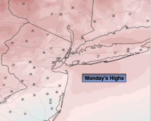
Mainly cloudy with an on and off light mix possible. Highs in the mid 30s.
Tuesday:
Snow/mix/rain likely. Highs in the mid 30s.