Synopsis:
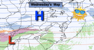
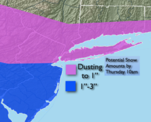
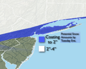
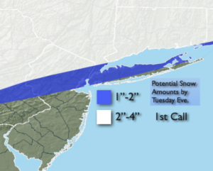
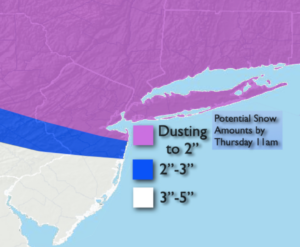
A weak system will pass to our South tonight into Thursday morning. This will produce a period of snow from around midnight into the morning hours. The snow will be light and intermittent to the North, steadier and heavier to the South. The snow will end around sunrise to the North and West and taper off at the coast by mid morning. The steadier precipitation has moved North so amounts have been raised throughout the region. The jackpot zone for snow will be Southern areas where 3″-5″ is likely. The sun will return during the day with readings near freezing.
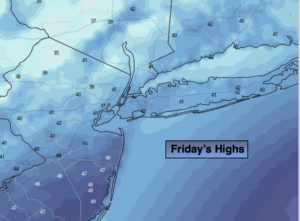
A second weak system will pass well South of the area on Friday. Any morning clouds will give way to mainly sunny skies. Despite the bright conditions it will be bitterly cold with readings only in the 20s as Arctic high pressure influences our region.
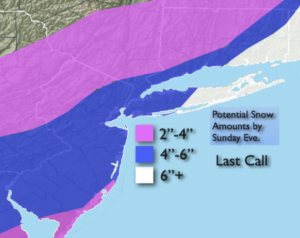
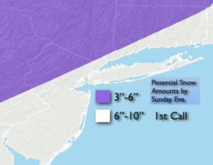
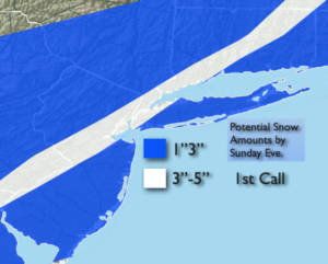
The weekend will start with a bit of sun Saturday morning but clouds will lower and thicken and I am introducing the chance of late day snow with a developing coastal low over the Carolinas. Snow or a mix is likely Saturday night. The storm will move up and off the NJ by Sunday morning. Snow or a mix will wind down by late morning. An accumulation is possible. Amounts are yet to be determined, but it doesn’t look like a “big one” at this time. Valentine’s Day Afternoon will feature the return of some sun with highs in the mid 30s.
A mix of sun and clouds will greet us for Presidents’ Day. The cold will remain with highs only around 30º.
Needless to say, we are in a very active pattern.
Stay Tuned.
Keep it here for a no nonsense, no hype forecast.
Tonight:
A period of snow. Light and intermittent to the North. Steadier and heavier to the South. Lows in the mid 20s in the City, the teens inland. North winds at 5mph.
Thursday:
Early morning snow, mainly from the City and to the South and East, otherwise increasing sunshine. Highs in the mid 30s.
Friday:
Sun and clouds. Very cold. Highs in the 20s.
Saturday:
Mostly cloudy. Potential for late day light snow. Cold. Highs around 30º.
Sunday (Valentine’s Day):
Morning snow, mix potential. Afternoon sun possible. Highs in the lower to mid 30s.
Monday:
Partly sunny. Highs in the mid 30s.