Synopsis:
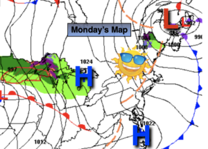
Our much advertised warmup will begin today. Strong high pressure will be in control. This system will become a warm weather maker for Wednesday and Thursday. Readings will get well above average under a mix of sun and clouds. A Summer feel is on the way. A cool front will near the region on Thursday. A spot PM Shower is possible.
On Friday, the front will push through. An isolated shower is possible early on. Temperatures will still be several degrees above the average highs of the mid 60s.
A cooler push of Canadian air will arrive on Saturday with readings a few degrees below the average high of 67º. A mix of sun and clouds is expected with a gusty wind.
Stay tuned.
Keep it here for a no nonsense, no hype forecast.
Today:
Mostly sunny, milder. Highs in the upper 60s. South winds at 5-10mph.
Tonight:
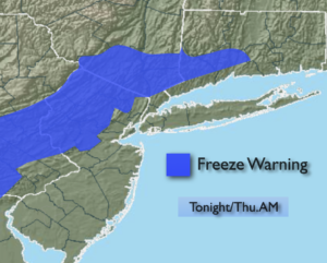
Mostly clear, much milder than recent nights. Lows in the upper 50s in the City, the upper 40s to 50s inland. Light and variable winds.
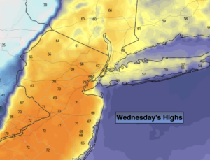
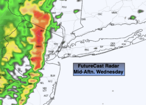
Wednesday:
Sunny. Much warmer. Highs in the lower to mid 80s.
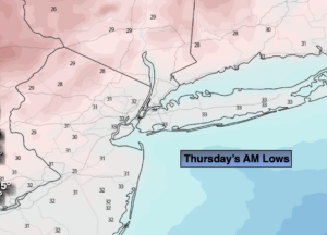
Thursday:
Sun and clouds. Warm. Spotty afternoon showers possible. Highs in the upper 70s.
Friday:
Sun and clouds. Cooler. Isolated morning showers possible. Highs around 70º.
Saturday:
Partly sunny. Much cooler. Highs in the mid 60s.