Synopsis:
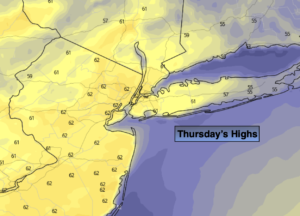
Early morning rain or snow showers East will give way to a mix of sun and clouds on Christmas Eve. High pressure will settle over the Southeastern US and it will turn out to be a decent day.
Clouds will roll in tonight ahead of the next system from moving in from the West.
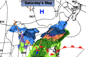
It looks like we’ll have to wait another year for a white Christmas. The day will start off with a period of rain. The rain will taper off to spotty showers during the day and much of the afternoon should be dry. Temperatures will be a few degrees above the average high of 42º.
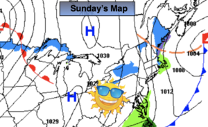
Sunday will be the better half of the weekend with abundant sun with just above average temperatures. The wind will be busy.
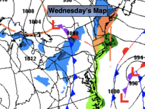
Weak low pressure over the Great Lakes will weaken as it approaches the region on Monday. More clouds than sun is expected. The latest computer models keep the region precipitation free.
The sun will dominate on Tuesday. Temperatures will still be above average.
JMW wishes all a very Merry Christmas!
Stay tuned..
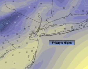
Christmas Eve:
Early morning snow or rain showers East, otherwise becoming mostly sunny. Highs in the mid 40s. Northwest winds at 5-10mph.
Tonight:
Thickening clouds. Showers developing late. Lows around 40º along the coast, the 30s inland. Southeast winds at 5mph.
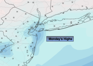
Christmas Day:
Morning rain will give way to spotty showers. Mild. Highs in the mid 40s.
Sunday:
Mostly sunny. Windy. Highs in the mid 40s.
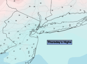
Monday:
Clouds and sun. Highs in the lower 40s.
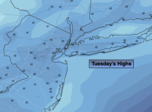
Tuesday:
Mostly sunny. Mild. Highs in the upper 40s.