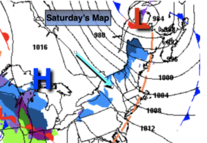
Synopsis:
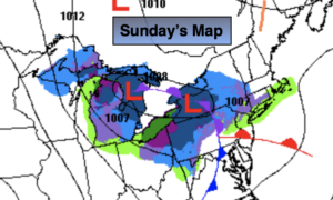
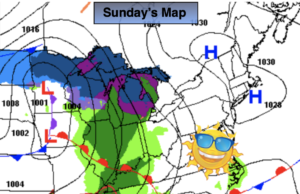
A bright, cool Sunday is anticipated for the tri-state area as high pressure controls the East coast. Readings will be right where they should be this time of the year in the mid to upper 40s.
Tonight temperatures will actually rise as a warm front swings through. Scattered showers are possible late.
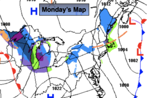
Ahead of a cold front on Monday it will be balmy. Spotty showers are possible in the morning and then again in the evening. Readings will pop to near 60º with a gusty South wind.
Much colder conditions are expected for Tuesday as high pressure moves in from the North.
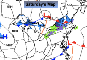
On Wednesday many of the models have an area of low pressure developing to our South. The exact track will determine how much precipitation, if any will fall. There will be cold high pressure to the North. At this time, the forecast is for the possibility of rain with the potential of some wet snow inland. This is not etched in stone.
Behind the departing system on Thursday skies will be sunny and a brisk, cold wind will prevail.
You know where to find a no hype, no nonsense forecast.
Stay tuned..
Sunday:
Mostly sunny. Highs in the mid to upper 40s. Northwest to East winds at 5mph.
Tonight:
Becoming mostly cloudy. Showers possible late. Temperatures rising to near 50º by morning along the urban corridor, the 40s inland. Southeast winds 5mph.
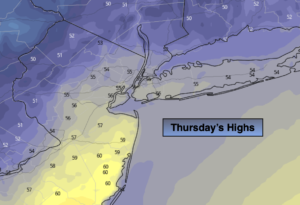
Monday:
Mostly cloudy. Balmy. Spotty showers. Highs around 60º.
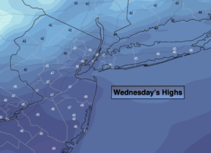
Tuesday:
Mostly sunny. Much colder. Highs in the lower 40s.
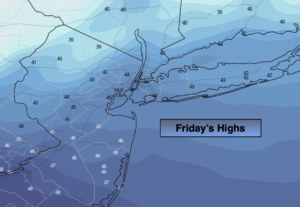
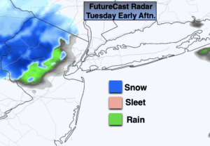
Wednesday:
Potential for rain or wet snow. Highs around 40º.
Thursday:
Sunny and cold. Highs in the upper 30s.