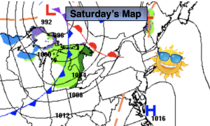
Synopsis:
The week will be tranquil with readings at or below average. The sun will dominate. A Northwesterly flow will prevail as the jet stream will be moving in from West to East. This setup will prevent any storm development or extremes in temperature.
Seasonable readings (highs near 50º) are expected for today.
Spring arrives on Tuesday at 11:06pm. It’ll be a cool greeting as cooler air from Canada moves into the region. Wednesday will be more seasonable ahead of the next cold front. Then readings will become chilly once again for the end of the week.
Stay tuned.
Keep it here for a no nonsense, no hype forecast..
Monday:
Mostly sunny. Seasonable. Highs around 50º. West to Northwest winds at 10-20mph.
Tonight:
Partly cloudy. Lows in the mid 30s in the City, the upper 20s inland. West to Northwest winds at 8-12mph.
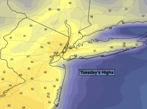
Tuesday:
Partly sunny. Cooler. Highs in the mid 40s.
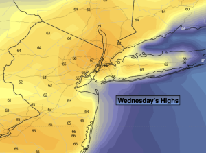
Wednesday:
Mostly sunny. Highs in the lower 50s.
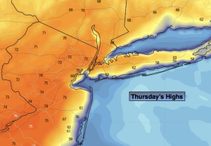
Thursday:
Mostly sunny. Cooler. Highs in the lower to mid 40s.
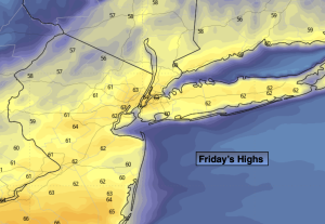
Friday:
Partly sunny. Highs in the mid 40s.