Synopsis:
The storm that gave the region a wet start to the weekend will move into New England today and strengthen considerably. This will cause winds to increase and become strong out of the Northwest. A mix of sun and clouds is expected. Scattered rain and snow showers are possible as an upper level low swings through. Temperatures will drop through the 40s during the day. Average highs are in the upper 40s. Winds will gusts up to 40mph later in the day.
The blustery conditions will continue on Monday and the chill will remain. Winds could gust in excess of 50mph.
Tuesday through Thursday will be more tranquil with milder readings as high pressure takes control. There will definitely be a Spring feel!
Enjoy the daylight later in the evening with return of Daylight Saving Time!
Stay tuned.
Keep it here for a no nonsense, no hype forecast..
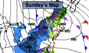
Sunday:
Sun and clouds. Windy. Chance of rain and snow showers. Highs around 50º in the morning then falling through the 40s. West to Northwest winds increasing to 15-30mph with gusts to 40mph late day.
Tonight:
Scattered flurries early, otherwise partly cloudy, windy and cold. Lows near freezing along the urban corridor the upper 20s inland. West to Northwest winds to 15-30mph with gusts to 40mph.
Monday:
Partly sunny, windy and chilly. Highs in the upper 40s.
Tuesday:
Sunny and pleasant. Milder. Highs in the upper 50s.
Wednesday:
Sunny. Mild. Highs in the lower 60s.
Thursday:
Partly sunny. Very mild. Highs in the mid 60s.