Synopsis:
Tuesday will be seasonable with a southwesterly flow developing on the backside of the departing high.
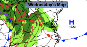
The next threat of showers will come with an approaching front on Wednesday morning. It doesn’t look like anything heavy.
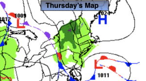
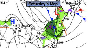
Cooler conditions are expected Thursday as a Canadian airmass pays a short visit. It’ll be a similar forecast for Friday and Saturday as offshore high pressure dominates.
Stay tuned.
Keep it here for a no nonsense, no hype forecast.
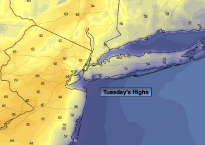
Tuesday:
Mostly sunny. Seasonable. Highs in the mid 60s. South winds increasing to 10-20mph during the afternoon.
Tonight:
Becoming mostly cloudy. Lows in the 40s throughout. South winds at 5-10mph.
Wednesday:
Mostly cloudy. Scattered morning showers. Highs in the mid 60s.
Thursday:
Mostly sunny. Cooler. Highs in the upper 50s.
Friday:
Sunny. Highs around 60º.
Saturday:
Partly sunny. Highs in the lower 60s.