Synopsis:
Our string of above average temperatures will continue for the last weekend of Winter. Today will be sunny. St. Patrick’s Day will feature more clouds than sun with a chance of an isolated shower as a front moves in.
Seasonable readings are expected for Monday (near 50º).
Spring arrives on Tuesday. It’ll be a chilly greeting as cold air from Canada moves into the region. The Northwest cooler flow will continue into midweek. It’ll be bright and dry.
Stay tuned.
Keep it here for a no nonsense, no hype forecast..
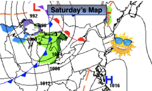
Saturday:
Sunny. Highs in the upper 50s. West to Southwest winds at 5-10mph.
Tonight:
Partly cloudy. Lows in the 40s throughout. South winds at 5-10mph.
St. Patrick’s Day:
Clouds and sun. An isolated shower. Mild. Highs around 60º.
Monday:
Mostly sunny. Seasonable. Highs around 50º.
Tuesday:
Partly sunny. Cooler. Highs in the mid 40s.
Wednesday:
Partly sunny. Highs in the upper 40s.