Synopsis:
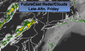
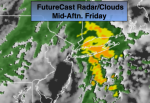
Hazy, very warm and humid conditions will persist into this evening. An approaching cool front will spark scattered storms during the evening. Some of the storms maybe strong. Not all areas will get in on the action.
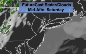
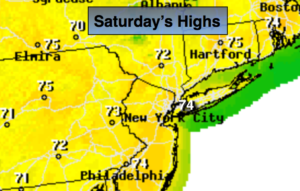
More comfortable temperatures will be with us for the upcoming weekend. Saturday looks dry with sunshine giving way to increasing clouds. A wave of low pressure along the dying cool front to the South will cause scattered showers on Sunday. At this time it does not look like a washout.
Stay tuned.
Tonight:
Very warm and humid into this evening. An isolated storm, otherwise, partly cloudy and becoming much cooler after midnight. Lows around 60º in the City, the 50s inland. Southwest winds becoming Northwest at 10-20mph with higher gusts.
Saturday:
Sun will give way to afternoon clouds. Much more comfortable. Highs in the mid 70s. Northwest winds becoming Southwest at 5-10mph.
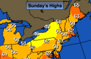
Sunday:
Mostly cloudy with scattered showers. Highs in the lower 60s.
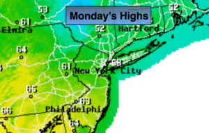
Monday:
Partly sunny. Highs in the mid 60s.
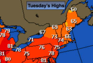
Tuesday:
Sunny. Highs around 70º.
Wednesday:
Sunny. Highs in the lower 70s.
Keep it here for a no nonsense, no hype forecast.