Synopsis:
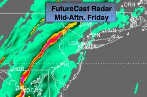
A strong Southerly flow will continue tonight ahead of sharp cold front and developing storm on the front. Readings will remain well into the 50s for a majority of the night with periods of rain. There will be dry times with areas of fog, but when the rain falls it could be heavy at times. Local flooding is possible.
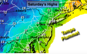
The significant cold front will move through within a couple hours of sunrise. Rain is likely through early Saturday morning. The temperature gradient from the immediate coast to 150 miles North and West is extreme-from the 50s to the 20s. If the low is far enough East the cold air gets a chance to spill in before the precipitation ends over the Northwestern suburbs a freezing rain or a mix may occur. This has to monitored very closely. Whatever the case, the precipitation will end Saturday morning with temperatures falling into the 20s and 30s during the afternoon with returning sunshine.
Colder times will be with us for the rest of the weekend and into next week. A weak Alberta Clipper will race through the area on Tuesday with scattered snow showers. A more significant storm may develop off the coast on Wednesday. Where this storm forms and tracks is anybody’s guess, but it does have a low potential at this time to give the area accumulating snow.
Stay tuned.
Tonight:
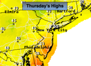
Warm with periods of rain and thunderstorms. The rain maybe heavy at times. Areas of fog. Lows in the 50s then dropping into the 40s in the City, the 40s then dropping into the 30s inland. South wind at 10-20mph becoming Northwest toward dawn.
Saturday:
Periods of rain in the morning. Freezing rain or a mix is possible inland. The sun will make an appearance during the afternoon. A morning high in the 40 at the coast ,30s inland with readings falling into the 30s along the coast, the 20s inland during the afternoon. Northwest winds at 15-2mph.
Sunday:
Partly sunny, breezy and much colder. Highs in the upper 20s.
Monday:
Partly sunny, breezy and colder. Highs in the upper 20s.
Tuesday:
Mostly cloudy with a chance of snow showers. Highs in the mid 30s.
Wednesday:
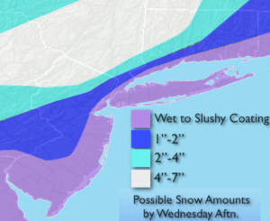
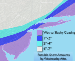
Mostly cloudy with a low potential of accumulating snow. Highs around 30º.
Keep it here for a no nonsense, no hype forecast.