Synopsis:
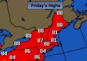
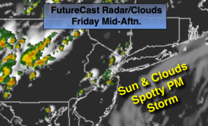
A mix of sun and clouds, very warm and humid conditions are expected today. A front will approach late in the day. Spotty storms are possible later in the afternoon and evening. Some of the storms could be strong to severe. Keep an eye to the sky for threatening weather from mid-afternoon on.
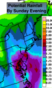
The weekend should be mainly dry as high pressure from the West begins to take hold under a mix of sun and clouds. It’ll be much less humid with seasonal readings.
Looking ahead, another Bermuda high will begin to setup shop mid to late week with heat and humidity returning.
Stay tuned.
Today:
Hazy very warm and humid. An spotty storm is possible later in the day or evening. Highs in the mid to upper 80s. South winds at 5-10mph.
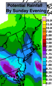
Tonight:
Scattered strong to severe storms during the evening, otherwise, mostly cloudy. Lows in the lower 70s in the City, the 60s inland. Southwest winds under 5mph.
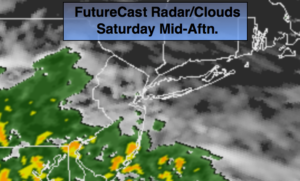
Saturday:
Clouds and sun. An isolated afternoon storm is possible. Most areas will remain dry. Highs in the mid 80s.
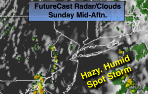
Sunday:
Mostly sunny. Highs in the mid 80s.
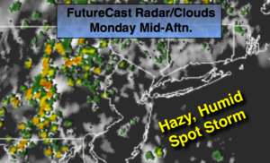
Monday:
Partly sunny. Highs in the mid 80s.
Tuesday:
More clouds than sun. Humid. Scattered showers are possible. Highs in the mid 80s.
Keep it here for a no nonsense, no hype forecast.