Synopsis:
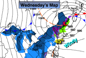
The workweek will be bright with moderating temperatures through Wednesday as high pressure works in from the West. A cold front will pass Wednesday night with the thermometer falling to near freezing for highs on Thursday.
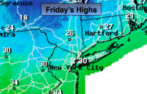
A weak disturbance will move in on Friday with scattered snow showers.
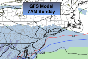
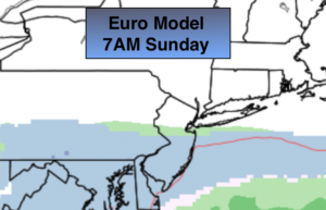
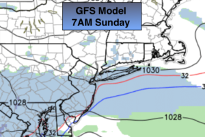
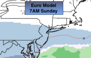
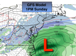
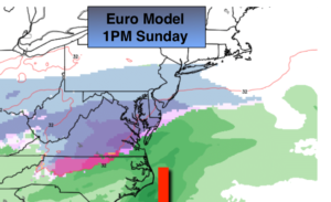
A lot of chatter already about next weekend. The latest computer guidance suggests the weekend will start off dry. The signal is there for a potential heavy precipitation event in the East starting later Saturday and into Sunday. PLEASE don’t listen to any outlets at this time stating a snowstorm is on the way. The event is six days away. It’s pure hype. There will be an incredibly tight thermal gradient along the East coast. A shift of 50 miles either way would be the difference between mostly rain or mostly snow. This has to be watched. JMW will continue to monitor.
You know where to find a no hype, no nonsense forecast.
Stay tuned.

Enjoying a Sunday Morning (yesterday) on CBS2 with Cindy and Valerie.
Today:
Sunny. Highs in the mid to upper 30s. North winds at 5-10mph.
Tonight:
Clear and cold. Lows in the mid 20s in the City, the single digits and teens inland. Northwest winds at 5mph.
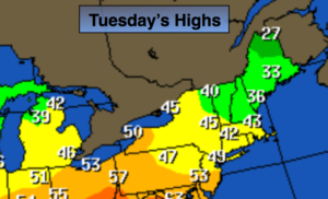
Tuesday:
Sunny. Highs around 40º.
Wednesday:
Partly sunny. Highs in the lower 40s.
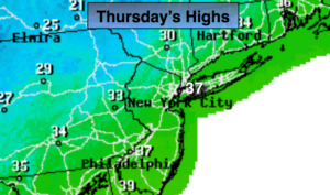
Thursday:
Sunny and colder. Highs in the lower to mid 30s.
Friday:
Mostly cloudy with scattered rain or snow showers. Highs in the upper 30s.