Synopsis:
The low pressure system that gave Southern NJ an accumulating snow will move farther offshore tonight. Scattered light snow may continue into the overnight hours over Southern NJ any additional accumulations will be light. Skies will be mainly clear North to Mainly cloudy from the City and South.
The workweek will be bright with moderating temperatures through Wednesday as high pressure works in from the West. A cold front will pass Wednesday night with the thermometer falling to near freezing for highs on Thursday.
A weak disturbance will move in on Friday with scattered snow showers.
A lot of chatter already about next weekend. There will be a low on the map. How it interacts with Arctic air coming in from Canada is anyone’s guess at this point. But the signal is there for a potential heavy precipitation event in the East. PLEASE don’t listen to any FAKE WEATHER NEWS about a snowstorm this far out in the game. It’s pure hype this far out.
You know where to find a no hype, no nonsense forecast.
Stay tuned.
Tonight:
Scattered areas of light snow over Southern NJ otherwise Clear North, partly cloudy elsewhere. Lows in the mid 20s in the City, the teens inland. Northeast to North winds at 8-12mph.
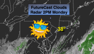
Monday:
Sunny. Highs in the upper 30s. North winds at 5-10mph.
Tuesday:
Sunny. Highs around 40º.
Wednesday:
Partly sunny. Highs in the lower 40s.
Thursday:
Sunny and colder. Highs in the lower to mid 30s.
Friday:
Mostly cloudy with scattered snow showers. Highs in the upper 30s.