Synopsis:
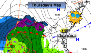
A weak low off the Virginia coast along with upper level energy moving through the area early this morning will be responsible for the clouds. The sun will return as high pressure will moves in along with above average temperatures through Friday.
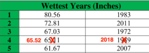
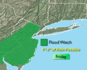
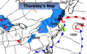
A low will be just to our South on Saturday morning. The low will move off the NJ coast and to near Cape Cod by evening. Periods of rain is expected. The strong Pacific jet stream continues to dominate and there is no supply of cold air, hence the rain and not snow. This pattern of no intrusion of Arctic air looks to continue for the first ten days of January. Sorry snow lovers, the wait continues.
You know where to find a no hype, no nonsense forecast.
Stay tuned.
Today:
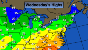
Early clouds, otherwise, becoming partly sunny. Mild. Highs in the upper 40s. The average high is in the upper 30s. West to Northwest winds at 10-20mph.
Tonight:
Mostly clear. Lows in the mid 30s in the City, the 20s inland. Southeast winds at 5mph.
Friday:
Sunny. Highs in the mid to upper 40s.
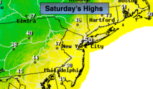
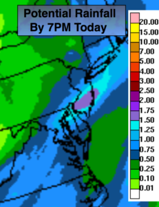
Saturday:
On and off rain. Highs in the mid 40s.
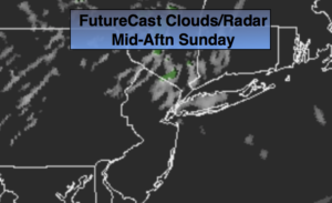
Sunday:
Partly sunny. Highs in the mid 40s.
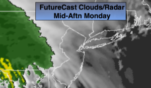
Monday:
Partly sunny. Highs in the lower 40s.
Keep it here for a no nonsense, no hype forecast.