Synopsis:
A cold front moving through this morning will result in scattered flurries, otherwise the sun will return and it’ll be seasonally cold. Average highs are around 40º.
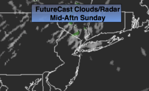
On New Year’s Eve another storm will take a similar track to Friday’s system. Yep, more rain on the way. The last day of 2018 will start off with sun but clouds will roll in and rain will develop during the afternoon. At the stroke of midnight it’ll be raining but it will be mild. Temperatures for the majority of the day will be in the 40s. The actual high for the day will occur at the stroke of midnight. At this time readings will be around 50º! A far car from last year’s New Year’s Eve when it was 9º!
January 1st won’t feel like the season, as the warm temperatures will stick around. Temperatures will be near 60º!
Colder air will rush in for midweek. There has been a significant change with the last run of the computer guidance that meteorologists analyze. All the models now have a storm on the map developing over the Southeast on Thursday and moving toward the region. The exact timing, track and how much cold air will be around is yet to be determined. Be aware that the potential for snow and or rain is there for Thursday into Friday.
You know where to find a no hype, no nonsense forecast.
Stay tuned.
Today:
Early scattered flurries, otherwise, mostly sunny and much colder. Highs around 40º. Northwest to West winds art 5mph.
Tonight:
Clear and cold. Lows in the mid 30s in the City, the 20s inland. Light and variable winds.
New Year’s Eve:
Early sun giving way to clouds. Rain develops during the afternoon. Mild. Highs reaching into the 50s by midnight.
New Year’s Day:
Partly sunny and warm. Highs near 60º.
Wednesday:
Mostly sunny. Colder. Highs around 40º.
Thursday:
Mostly cloudy with a chance of rain and or snow. Highs in the 30s.
Keep it here for a no nonsense, no hype forecast.