Synopsis:
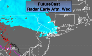
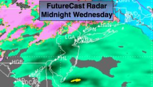
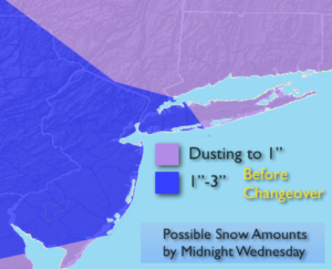
A weak disturbance moving through tonight will spark off areas of light snow showers or a light mix. The best chance of any precipitation will be from NYC to the North. Again, this will not be a big deal. A coating is possible North.
Thursday will be mainly sunny and chilly as high pressure works in.
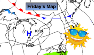
On Friday, another weak disturbance moving through may spark a few snow flurries, otherwise a mix of sun and clouds is expected.
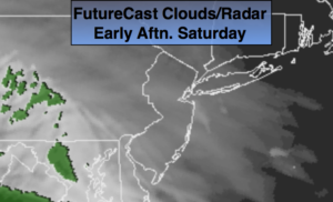
Saturday’s low now looks very insignificant. Mostly cloudy skies are expected with showers of rain or snow at times, again not a big deal.
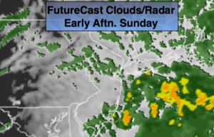
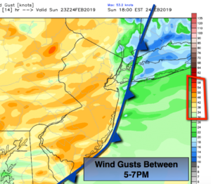
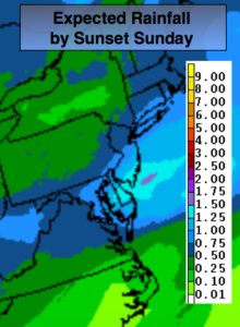
Sunday will start off with sun, but clouds will increase and thicken during the day. A storm will track up from the South. Showers are likely to develop during the afternoon. The track of the system is uncertain Sunday night. The GFS has a colder snowier solution with its latest run-an offshore solution. The European model takes the storm over the area. Taken verbatim this model would give the majority of the region rain with a mix inland. The models have been horrible this Winter. Who knows, with the next run the storm may not even be there! Stay tuned.
Keep it here for a no nonsense, no hype forecast.
Tonight:
Mostly cloudy. Scattered areas of snow showers or a mix. Some areas will be precipitation free. Lows in the upper 20s in the city, around 20º inland. Southeast to North winds at 5mph.
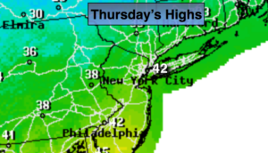
Thursday:
Mostly sunny and chilly. Highs around 40º. Northwest winds at 8-12mph.
Friday:
A mix of clouds and sun, flurries are possible in the morning. Highs around 40º.
Saturday:
Mostly cloudy. Scattered showers and or flurries are possible. Highs around 40º.
Sunday:
Morning sun, otherwise thickening clouds with shower developing during the afternoon. Highs in the lower 40s. At this time, rain is likely for a majority of the area at Sunday night-a mix well inland.
Monday:
Party sunny, wind and cold. Highs in the mid 30s.