Synopsis:
A fairly quiet workweek is on the way. No storms are on the horizon as high pressure will be the main weather system affecting our region. Readings will be tolerable for March rising to near or above average by late week.
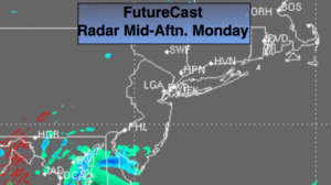
The sun should be the dominate feature through Wednesday. A weak system will pass to our South today and shouldn’t affect the NYC tri-state area (map above). Clouds will filter out the sun from time to time but that’s about it.
Spring arrives at Wednesday at 5:58pm EDT. This is the exact time when the sun’s direct rays crossed North of the equator.
Keep it here for a no nonsense, no hype forecast.
Today:
Sun and clouds. Highs in the mid 40s. Northwest to West winds at 5-10mph.
Tonight:
Becoming partly cloudy. Lows near freezing in the City, the upper teens and 20s inland. Southwest to Northwest winds at 5mph.
Tuesday:
Sunny. Highs in the mid 40s.
Wednesday:
Mostly sunny. Highs near 50º.
Thursday:
Mostly cloudy with a chance of showers. Mild. Highs in the lower to mid 50s.
Friday:
Partly sunny and becoming windy. Highs near 50º. Temperatures will fall during the afternoon.