Synopsis:
Tranquil conditions are expected for much of the workweek. Readings will be mild today with temperatures dropping back to more seasonal readings for mid March through midweek as high pressure moves in. Several days of sunshine are on the way. Temperatures will rise to above seasonal averages (the average high is in the upper 40s) by Thursday as the high slips off the coast and a return flow from the South takes hold.
The next chance of showers won’t arrive until Friday with an approaching cool front. Ahead of the front it’ll feel like Spring.
Keep it here for a no nonsense, no hype forecast.
Today:
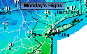
Mostly sunny. Mild. Highs around 50º. West winds at 10-20mph.
Tonight:
Mostly clear. Lows around freezing in the City, the 20s inland. Northwest winds at 10-20 mph.
Tuesday:
Mostly sunny, cooler. Highs in the mid 40s.
Wednesday:
Sunny. Highs in the mid 40s.
Thursday:
Partly sunny. Mild. Highs in the mid 50s.
Friday:
Mostly cloudy and balmy with scattered showers. Highs in the lower 60s.