Synopsis:.
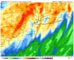
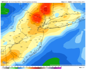
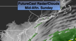
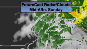
Low pressure continues to strengthen just Southeast of NYC. The storm will move over Long Island and toward Cape Cod. The heaviest and steadiest rain has pushed into New England. On and off rain is expected into this afternoon. The rain will taper off later in the day. There is a low potential for a bit of freezing rain and or sleet and wet snow well North and West as colder air filters down from the upper atmosphere. This doesn’t look like a major concern at this time. Most areas will receive between one and two inches of rain.
The beginning of the upcoming shortened workweek looks tranquil with plenty of sunshine and tolerable temperatures as weak high pressure settles over the Southeastern states.
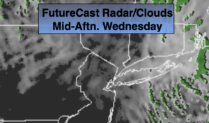
Getaway Wednesday will be very mild with a mix of clouds and sun. Spot showers are possible during the afternoon as a cold front approaches.
Thanksgiving will be much cooler and windy under a mix of sun and clouds. A strong Northwest flow will be with us do to a powerful Canadian maritime storm and strong high pressure over Central Canada.
Stay Tuned.
Keep it here for a no hype, no nonsense forecast.
Today:
On and off rain. A mix of freezing rain, sleet and or wet snow is possible in spots well North and West. The rain will taper off midday to mid afternoon. Skies may brighten later in the afternoon. Highs in the mid 40s in the City, near 50º over Long Island and coastal NJ and the 30s North and West. East winds becoming Northwest and increasing to 15-25mph.
Tonight:
Becoming mostly clear. Lows in the upper 30s in the City, the upper 20s to around freezing inland. Highs around 50º. West winds at 10-20mph.
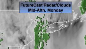
Monday:
Mostly sunny. Highs around 50º.
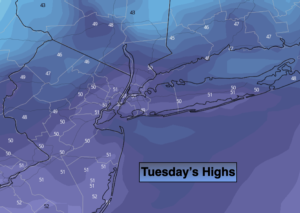
Tuesday:
Partly sunny. Highs in the mid 50s.
Wednesday (Getaway Day):
Partly sunny, breezy and mild. Spot afternoon showers are possible. Highs in the upper 50s.
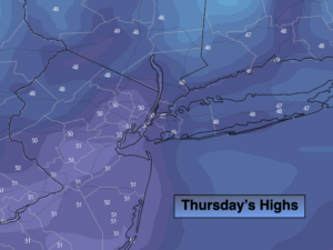
Thanksgiving:
Partly sunny, windy and chilly. Highs in the mid 40s.