Synopsis:.
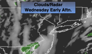
The jet stream, that river of air that guides our weather systems, is moving Southeast out of Canada. This flow will keep our temperatures several degrees below the average highs of the upper 40s through the week. Clouds will dominate today as upper level energy rides along the jet stream. A few flurries are possible early this morning, especially from the City and South. Another round of flurries are possible later today and tonight.
More sun will greet us on Thursday. Another unit of energy will work in on Friday. Sun will give way to clouds with late day flurries once again possible.
The weekend will be bright as high pressure works in. Saturday will only be in the 30s. Readings will rebound on Sunday.
No major storms are on the horizon.
Stay Tuned.
Keep it here for a no hype, no nonsense forecast.
Today:
More clouds than sun. Late day flurries are possible. Highs in the lower 40s. West winds at 5-10mph.
Tonight:
Mostly cloudy. Flurries possible. Lows in the mid 30s in the City, the upper 20s to lower 30s inland. West winds diminishing to 5-10mph.
Thursday:
Partly sunny.. Highs in the lower 40s.
Friday:
Sun and clouds. Scattered flurries. Highs around 40º.
Saturday:
Sunny and cold. Highs in the mid 30s.
Sunday:
Sunny. Not as harsh. Highs in the mid 40s.