Synopsis:.
It will be a 50/50 split weekend. Today will be sunny as a strong high over Eastern Canada supplies the clear and cold conditions. Temperatures will not get out of the 30s. The high to the North and a coastal storm off the Southeastern seaboard will create a strong Northeast flow. Windy conditions are expected along the coast. Minor coastal flooding may occur during times of high tide this weekend.
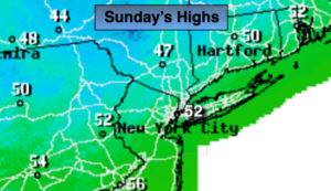
Grey skies will dominate on Sunday as the storm’s cloud shield works North. Coastal showers are possible in the afternoon. Readings will be well below the average high of 54º.
The storm off the East coast will graze our area Sunday night and Monday with the potential of on and off rain.
Early morning clouds Tuesday will give way to sunshine. A bright day is also expected for Wednesday as high pressure moves in from the West. Temperatures will remain below normal through the period.
Stay Tuned.
Keep it here for a no hype, no nonsense forecast.
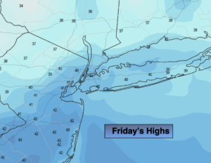
Today:
Mostly sunny. Much colder. Highs only in the mid to upper 30s. It will be windy along the coast. Northeast winds at 15-25mph with higher gusts.
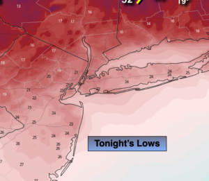
Tonight:
Clear to partly cloudy. Lows around 30º in the City, the teens and 20s inland. Northeast winds increasing at 10-15mph with higher gusts at the coast.
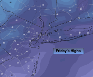
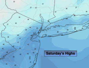
Sunday:
Mostly cloudy. Chilly. Afternoon coastal showers are possible. Breezy. Highs only around 40º.
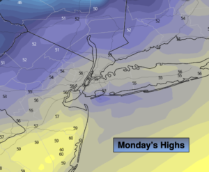
Monday:
Mostly cloudy. Chance of showers. Highs in the mid 40s.
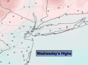
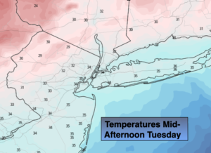
Tuesday:
Partly sunny. Highs around 50º.
Wednesday:
Mostly sunny. Highs in the upper 40s.