Synopsis:
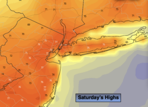
The weekend looks decent. Today, morning clouds will give way to partly sunny skies. It’ll be warm with readings several degrees above the average high of 71º. Sunday will be cooler as high pressure over the Northeast moves offshore and a wind off the cooler Atlantic takes hold. Skies will start off sunny but clouds will increase during the day.
Next week will be unsettled through at least Wednesday. An upper level low will move at a snails pace over the Central Appalachians. Meanwhile, a tropical system will ride up and off the Eastern Seaboard. The combination of these systems along with strong high pressure off the New England coast will cause times of rain through midweek. It will be difficult to time the rain until we get closer to the event.
Stay Tuned.
Keep it here for a no nonsense, no hype forecast.
Today:
Early morning clouds, otherwise partly sunny. Warm. Highs in the mid to upper 70s. North winds at 5-10mph.
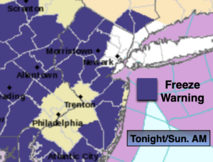
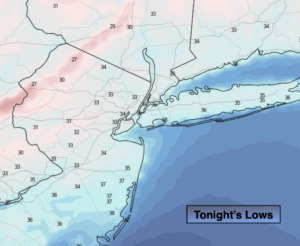
Tonight:
Partly cloudy. Lows in the mid 50s in the City, near 50º inland. Southeast winds less than 5mph.
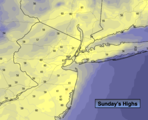
Sunday:
Partly sunny. Cooler. Highs in the mid 60s.
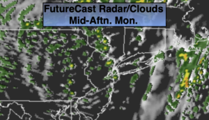
Monday:
Mostly cloudy with a chance of showers later in the day. Highs in the mid 60s.
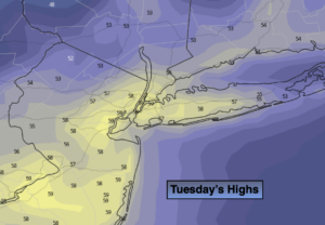
Tuesday:
Mostly cloudy with a chance of showers. Chilly. Highs in the upper 50s.
Wednesday:
Mostly cloudy with a chance of showers. Highs in the lower 60s.