
Synopsis:
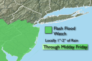
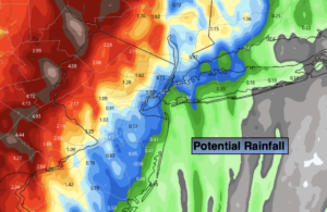
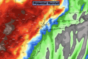
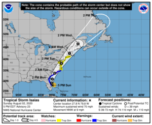
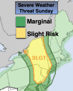
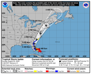
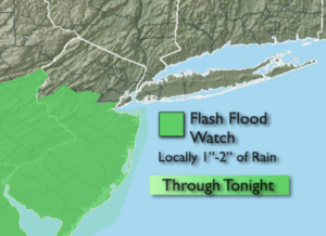
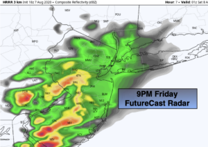
The weak disturbance to our South and West will move through our region this evening. This will result in scattered showers and storms mainly from the NYC vicinity and to the South. Some of the rain maybe torrential at times. Since the ground is saturated from recent rains from Tropical Storm Isaias it won’t take that much rain to causes some flooding issues. A Flash Flood Watch is in effect Central and Southern NJ tonight. The activity will wind down later this evening.
The pesky disturbance will move off the coast Saturday morning. Clouds will give way to a brighter afternoon. A spot afternoon storm can’t be ruled out. Readings will be a few degrees below the average high of the mid 80s. Sunday will be the better half of the weekend. High pressure will move in. Abundant sunshine and warm readings are expected.
It will turn hot and humid for the beginning of the week.
Stay Tuned.
Keep it here for a no nonsense, no hype forecast.
Tonight:
Mostly cloudy. Scattered shower and isolated storms. Locally heavy downpours are possible South of the City. Lows in the 60s throughout. Northeast winds at 5mph.
Saturday:
Early clouds, otherwise becoming partly sunny. A spotty PM storm. Highs in the lower 80s. Northeast to East winds at 5-10mph.
Sunday:
Mostly sunny and warm. Highs in the mid to upper 80s.
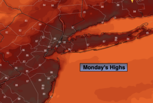
Monday:
Sunny, hot and humid. Highs around 90º.
Tuesday:
Hazy, hot and humid. Highs around 90º.
Wednesday:
Hazy, very warm and humid. Scattered afternoon storms. Highs in the upper 80s.