Synopsis:
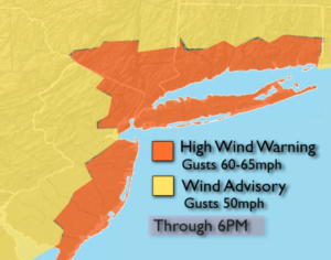
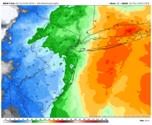
The intense low over Northern New England that was responsible for our wicked winds will move into Eastern Canada through today. This will allow our winds to slowly relax. It won’t be as harsh today. High pressure will move in from the the Great Lakes and allow for more sunshine. It’ll still be chilly.
Clear skies and nearly calm winds will result in plummeting temperatures inland. Areas of frost is likely North and West tonight. A Frost Advisory has been posted.
The weekend will start off bright with readings just below the average high of 64º as high pressure slips off the Eastern seaboard.
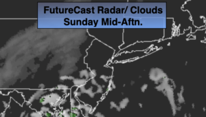
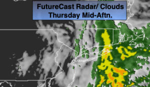
On Sunday, a storm will ride up the coast (This could be Tropical Storm Nestor. A low is developing in the Southern Gulf of Mexico as we speak and will move Northeast). The storm should move off the North Carolina coast and brush our area with clouds on Sunday. If the storm’s rain shield pushes far enough North and West coastal areas may get into some showers. JMW will continue to monitor the latest guidance on the track of this potential system.
Monday looks bright with high pressure moving in.
Stay Tuned.
Keep it here for a no nonsense, no hype forecast.
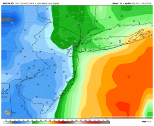
Today:
Sun and clouds. Breezy and chilly. Highs in the upper 50s. Northwest winds at 15-25mph.
Tonight:
Clear and cold. Scattered areas of frost inland. Lows in the mid 40s in the City, near freezing North and West. Winds diminishing to 5mph or less.
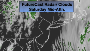
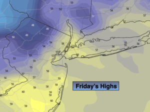
Saturday:
Sunny and cool Highs around 60º.
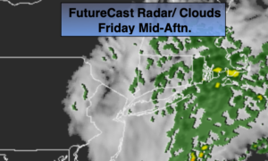
Sunday:
Mostly cloudy. Slight chance of showers for a few hours at the coast. Highs in the lower 60s.
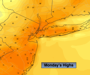
Monday:
Mostly sunny. Highs in the mid 60s.
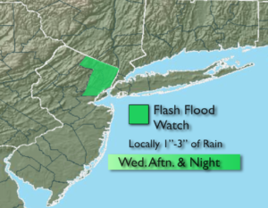
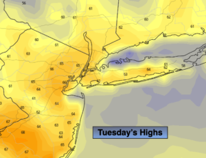
Tuesday:
Sun to clouds. Chance of afternoon showers. Highs in the mid 60s.