Synopsis:
Today temperatures will continue to moderate as high pressure moves offshore and a Southerly wind develops. Skies will be mainly sunny but clouds will work in during the afternoon. Readings will be just below seasonal levels (which is 70º).
A warm front will move in the region tonight with clouds and scattered showers. It will be much milder than recent nights.
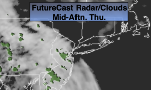
If you have been waiting for some warm weather, your wish will be granted on Friday. Temperatures sky rocket into the 80s as a strong Southwesterly flow takes shape-a late June feel for sure. Morning clouds will give way to partly sunny skies. A few late day showers or thunderstorms are possible as a weak front approaches.
The weekend looks decent with plenty of sunshine. Saturday will be warm after the morning clouds depart. Sunday will be cooler as high pressure over the Northeast moves offshore and a wind off the cooler Atlantic takes hold.
Stay Tuned.
Keep it here for a no nonsense, no hype forecast.
Today:
Sun will give way to afternoon clouds. Highs in the mid 60s. Winds becoming South at 5-10mph.
Tonight:
Mostly cloudy with scattered showers. Much milder than recent nights. Lows in the upper 50s in the City, the lower to mid 50s inland. South winds at 5mph.
Friday:
Morning clouds with give way to partly sunny skies, much warmer. Chance of late day showers or storms. Highs 80º-85º.
Saturday:
Mostly sunny. Warm. Highs in the mid to upper 70s.
Sunday:
Partly sunny. Cooler. Highs in the mid 60s.
Monday:
Mostly cloudy with a chance of showers. Highs in the mid 60s.