Synopsis:
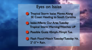
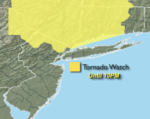
***Tornado Watch for the entire area until 4pm. Keep an eye to the sky for threatening weather. A tornado watch means conditions are favorable for possible tornadoes. It does not mean that a tornado is happening***
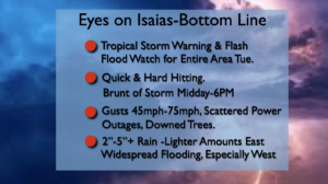
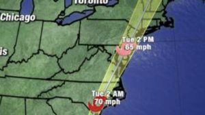
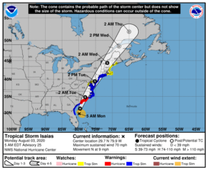
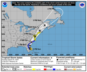
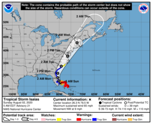
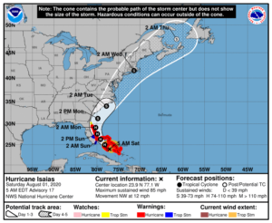
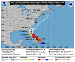
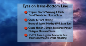
Isaias will ride inland just East of the I-95 corridor and through our area today. The morning will feature areas of rain and storms mainly well West and North of the coast. Not much in the way of rain and wind is expected for the majority of the region. The brunt of Isaias will be from midday to early evening, around a six hour period. A round of heavy rain and Tropical Storm force winds will occur during this time.
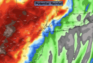
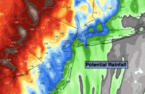
Flooding is quite likely where the heavy bands set up. As of this writing the heaviest axis of rain looks to fall along and to the West of the storm track. A Flash Flood watch has been posted for Tuesday the possibility of 1″-4″+ of rain. Much lighter amounts of rain are likely to the East.
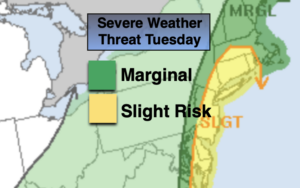
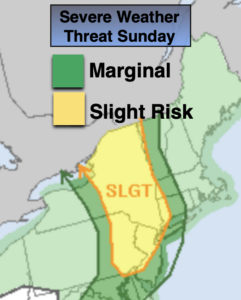
A Tropical Storm Warning has been issued for the entire tri-state area. Winds will gust between 45-75mph. I would prepare for possible power outages, especially near and along the coast where winds will be strongest. Tree limbs and weak rooted trees may come down. There is also the slight risk of severe thunderstorms. Isolated tornadoes are possible. Please be vigilant during the afternoon as conditions will be changing rapidly.
There will be a storm surge with Isaias. A bit of good news, the brunt of the storm will not coincide with high tide. Even so, the tidal surge may cause an inundation of one to possibly three feet.
The storm will be a quick hitter and the sun may even shine later in the afternoon especially to the South and West of the City.
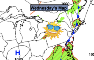
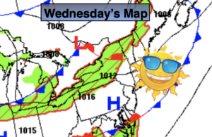
The sun will return on Wednesday. High pressure will dominate and result in fair weather through the end of the week.
Stay Tuned.
Keep it here for a no nonsense, no hype forecast.
Today:
Mainly dry for much of the area this morning. The exception being areas well to the North and to the West. Tropical storm conditions expected by midday and during the afternoon. Areas of heavy rain and gusty winds moving in from South to North. Very humid. Highs in the upper 70s. Southeast winds increasing to 20-40mph with gusts of 45mph to 75mph.
Tonight:
Becoming mostly clear. Less humid. Lows in the lower 70s in urban areas, the 60s inland. Southwest to West winds diminishing to 5-10mph.
Wednesday:
Mostly sunny. Highs in the mid 80s.
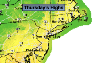
Thursday:
Partly sunny. Highs in the mid 80s.
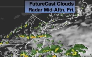
Friday:
Partly sunny. Isolated PM storm. Highs in the mid 80s.
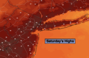
Saturday:
Partly sunny. Isolated PM storm. Highs in the mid 80s.