Synopsis:
We are in for a rollercoaster ride in temperature.
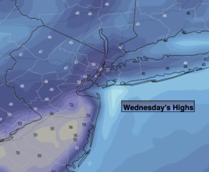
Today will be much milder under mainly sunny skies as high pressure moves overhead. Readings will flirt with 50º (a far cry from 0º windchills yesterday morning). Temperatures will return to seasonal levels by tomorrow as cooler air works in from the North.
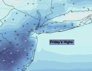
By Friday, another shot of Canadian air will chill the tri-state area with readings remaining in the upper 30s.
The weekend looks tranquil and chilly as high pressure continues to dominate the Mid-Atlantic and Northeast.
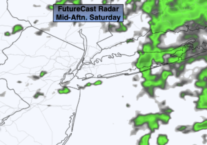
There are no major storms of concern in the near future and in fact, it will be precipitation free until further notice.
Stay Tuned.
Keep it here for a no nonsense, no hype forecast.
Today:
Sunny, milder. Highs near 50º. West winds at 8-12mph.
Tonight:
Clear. Lows in the mid 30s along the coast, the 20s inland. Northwest winds at 5-10mph.
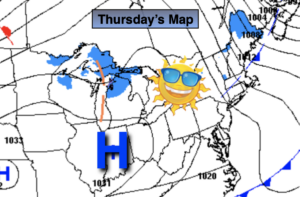
Thursday:
Sunny. Seasonal. Highs in the mid 40s.
Friday:
Partly sunny. Colder. Highs in the upper 30s.
Saturday:
Mostly sunny. Chilly. Highs in the lower 40s.
Sunday:
Sunny. Highs in the lower 40s.