Synopsis:
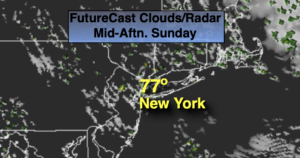
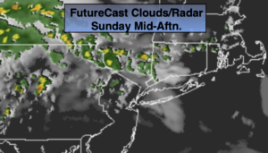
Today won’t be as bright as yesterday as a weak disturbance moving through results in more clouds for Sunday and scattered showers. Much of the time it will be dry. Readings will actually be a few degrees below the average high of the mid 80s. A spot storm is possible North of the City later today.
Heat and humidity will return for the upcoming week as a bubble of hot air develops around a Western Atlantic high pressure system. Hazy skies are expected with isolated afternoon storms. Readings will start off near average on Monday and then rise to hot levels mid to late week.
Stay tuned.
Keep it here for a no nonsense, no hype forecast.
Sunday:
Clouds and sun. Scattered showers mainly this morning. Many areas will remain dry. A few late day storms are possible to the North. Highs in the lower 80s. East to Southeast winds at 5-10mph.
Tonight:
Partly cloudy. Muggy. Lows in the lower 70s in the City, the upper 60s inland. Southeast winds at less than 5mph.
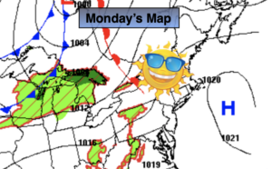
Monday:
Hazy, warm and more humid with spotty afternoon storms. Highs in the mid 80s.
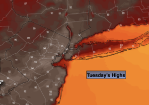
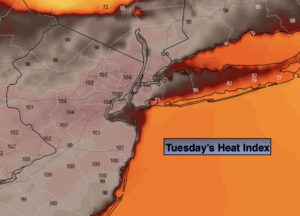
Tuesday:
Partly sunny, very warm and humid with spotty afternoon storms. Highs in the upper 80s.
Wednesday:
Hazy, hot and humid with spotty afternoon storms. Highs around 90º.
Thursday:
Hazy, hot and humid. Highs around 90º.
Friday:
Hazy, hot and humid. Highs in the lower 90s.