Synopsis:
A mild push is expected for today ahead of an approaching cool front. Temperatures will pop to around ten degrees above average-the average high is 48º. Early morning showers will give way to a mix of sun and clouds. An isolated afternoon or evening shower can’t be ruled out with the passage of the front.
Tranquil conditions are expected for Friday with seasonal readings as cooler air works in from Canada.
The weekend at this time looks dry with readings near seasonal averages as high pressure moves in from the West.
Ahead of another cold front on Monday readings will pop into the 50s. Showers are likely for the second half of the day.
You know where to find a no hype, no nonsense forecast.
Stay tuned.
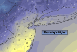
Thursday:
An early shower, otherwise a mix of clouds and sun. Milder. An isolated afternoon shower is possible. Highs in the mid to upper 50s. Southwest winds at 10-20mph with higher gusts.
Tonight:
Becoming mostly clear. Breezy. Lows in the lower 40s in the City, the 30s elsewhere. West to Northwest winds at 15-25mph.
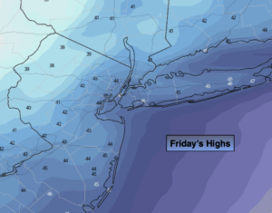
Friday:
Mostly sunny. Seasonal. Highs in the mid to upper 40s.
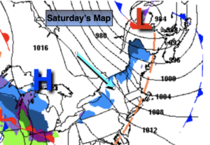
Saturday:
Mostly sunny.. Highs in the mid 40s.
Sunday:
Mostly sunny. Highs in the upper 40s.
Monday:
Mostly cloudy and mild with scattered showers. Highs in the mid 50s.