Synopsis:
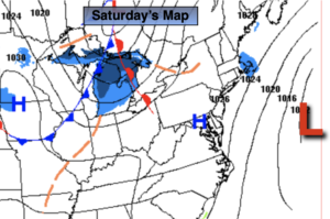
A storm off the Carolina coast will move out to sea and not affect us today. Despite mainly sunny skies readings will remain below freezing as high pressure moves overhead.
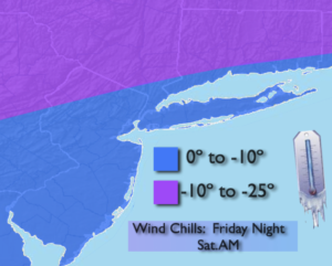
Tonight won’t be nearly as bitter as last night, although it will still be cold.
Temperatures will rise above freezing ahead of another cold front on Sunday. The sun will once again dominate.
We’ll be back in the freezer Monday as another shot of Canadian makes a visit.
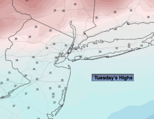
Readings will moderate on Tuesday to above average readings. The average high is 38º. There maybe a few rain or snow showers to contend with as a weak system rapidly moves through.
Wednesday we’ll be back in the freezer once again as another shot of cold air moves in.
There are no major storms on the horizon.
Stay tuned..
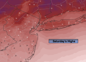
Saturday:
Mostly sunny. Highs around 30º. Northeast to South winds at 5mph.
Tonight:
Partly cloudy. Lows in the mid 20s in the City, the single digits and teens inland. Southwest to West winds at 5-10mph.
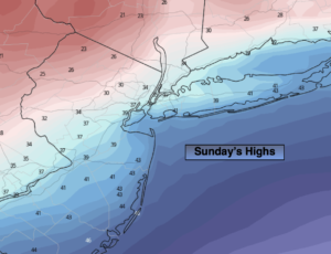
Sunday:
Mostly sunny. Not as harsh. Highs in the lower to mid 30s.
Monday:
Mostly sunny. Colder. Highs around 30.
Tuesday:
Mostly cloudy. A nice break from the cold. A few rain or snow showers are possible. Highs around 40º.
Wednesday:
Mostly sunny. Cold. Highs around 30º.